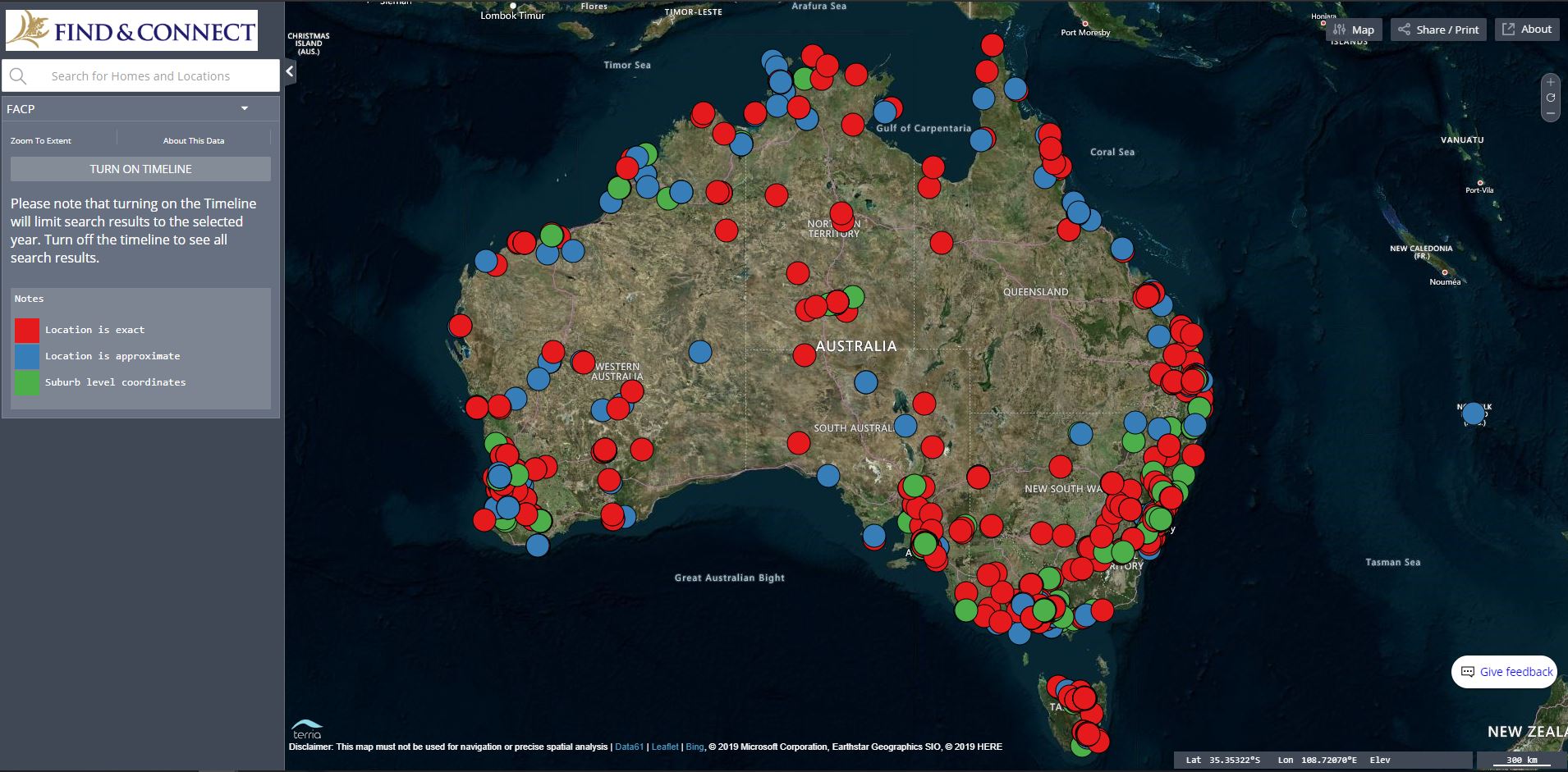
The Map of Children’s Homes shows the locations of institutions that provided out-of-home ‘care’ in Australia, including orphanages and missions, family group homes and babies’ homes. It is populated with data from the Find & Connect web resource.
Many people who spent time in ‘care’ as children may not remember the name or exact location of a Home, but may remember geographical landmarks or other nearby features. This map is intended to assist these people in locating the institutions they grew up in.
Please note this map displays historical data overlaid on modern satellite imagery, and is for information purposes only. It should not be used for navigation.
When first accessing the map, you will see a view of Australia, with different coloured place markers displayed. These place markers represent the institutions.
Red place markers represent exact locations, where we are confident in the precise location of the Home.
Blue markers indicate approximate locations. In most cases, the marker on the map is within 500 metres of where the Home was. For example, we may know the street a Home was on, but not the precise street number.
In rural areas, the approximate location may be within 1 kilometre of where the Home was located.
Green markers indicate only the suburb that a Home was in. In these cases we do not have more detailed information about the location of Home, other than the suburb.
If you know of more detailed location information for any of the Homes listed, please contact us and we will update the map.
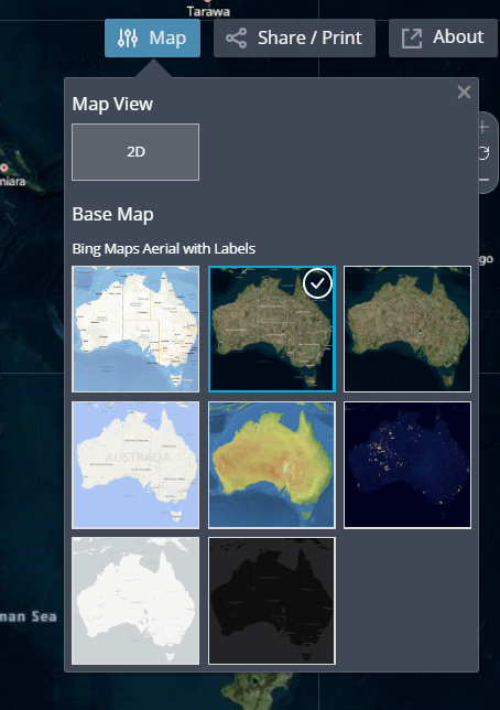
Switch from satellite to street map view by clicking on the “Map” button and selecting the view you want.
Browse the map by zooming to locations to see the Homes in that area.
Use the buttons on the right-hand side of the screen to zoom in and out and reset the map view back to all of Australia. You can also use your mouse scroll wheel to zoom.

Once you have located a Home of interest, click on its dot to bring up an information box about that Home. It will provide summary information, and a link so you can view the information about the Home on the Find & Connect web resource.
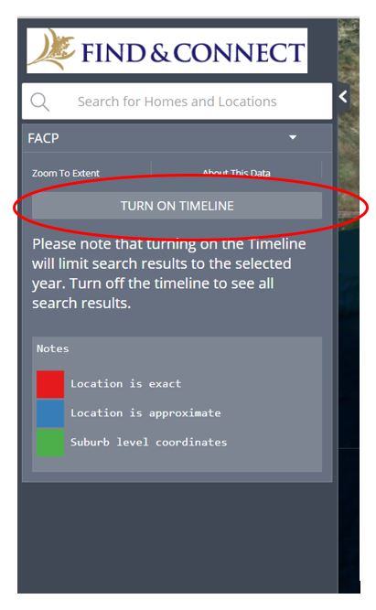
By default, all Homes from all dates are shown on the map. Limit what you can see by clicking the “Turn on Timeline” button on the workbench on the left-hand side of the screen
A timeline will appear at the bottom of the map. Use the slider to move to the time period you are interested in. All Homes which were open at that time will be displayed.
Use the search box on the workbench on the left-hand side of the screen to search for a Home name or suburb.
Search results are displayed below the Search box in the Search Results panel, with Homes appearing above suburbs.
The search shows results that exactly match the search words or phrase used. If you do not get the results you expected to see try alternate spellings and punctuation.
Please note that turning on the Timeline will limit search results to the selected year. Turn off the timeline to see all search results.
Some Homes moved location during the time they were open. This is indicated in the information box which pops up when a Home is selected.
Both the Home open and closed dates (ie the full time the Home was open) and the location dates (the time the Home was at this particular location) are displayed. If the location dates do not match up with the Home open and closed dates, this means the home was in another location during that time.
If you are zoomed out, or if there were multiple Homes at the same location over time, nearby Homes are listed at the bottom of the information box.
The information box contains information about whether a Home is still standing or has been demolished. This information was gathered in 2020 by comparing known images of or information about a Home to the appearance of the site on Google Maps Street View.
In some cases it was not possible to determine whether or not a Home was still standing, and in other cases this information may now be out of date. If you have more information about a Home please contact us and we will update the map.
You can print a map view or share it with others. To do this, click on “Share/Print” in the top right-hand corner, and either click “Copy” to get a link you can share, or “Print” to print off your current view.
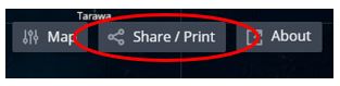
Please note that this feature shares or prints the precise view of the map you have open, including your search results, timeline and any information boxes open at the time of sharing/printing.
We welcome your feedback about the Map of Children’s Homes. We are looking to add more improvements and modifications as more people use the map. If you know of more detailed information for Homes, please get in touch so we can add this to the map.
You can send us feedback by going to our feedback form.
![]()
Cite this: https://www.findandconnect.gov.au:443/resources/about-the-map/
First published by the Find & Connect Web Resource Project for the Commonwealth of Australia, 2011

Except where otherwise noted, content on this site is licensed under a Creative Commons Attribution-NonCommercial-ShareAlike 3.0 Unported License